
Changing Climate
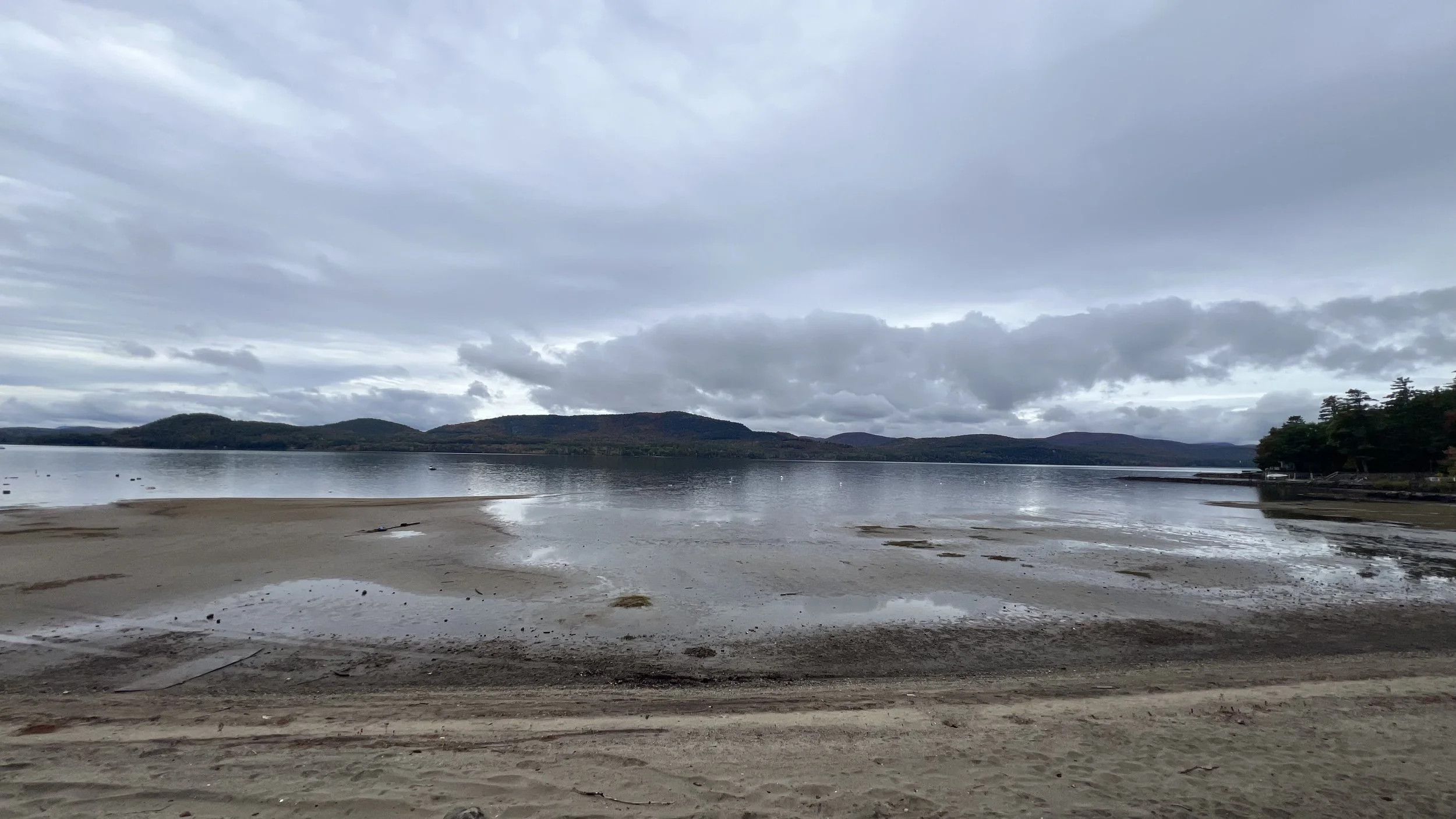
East Shore September 2026
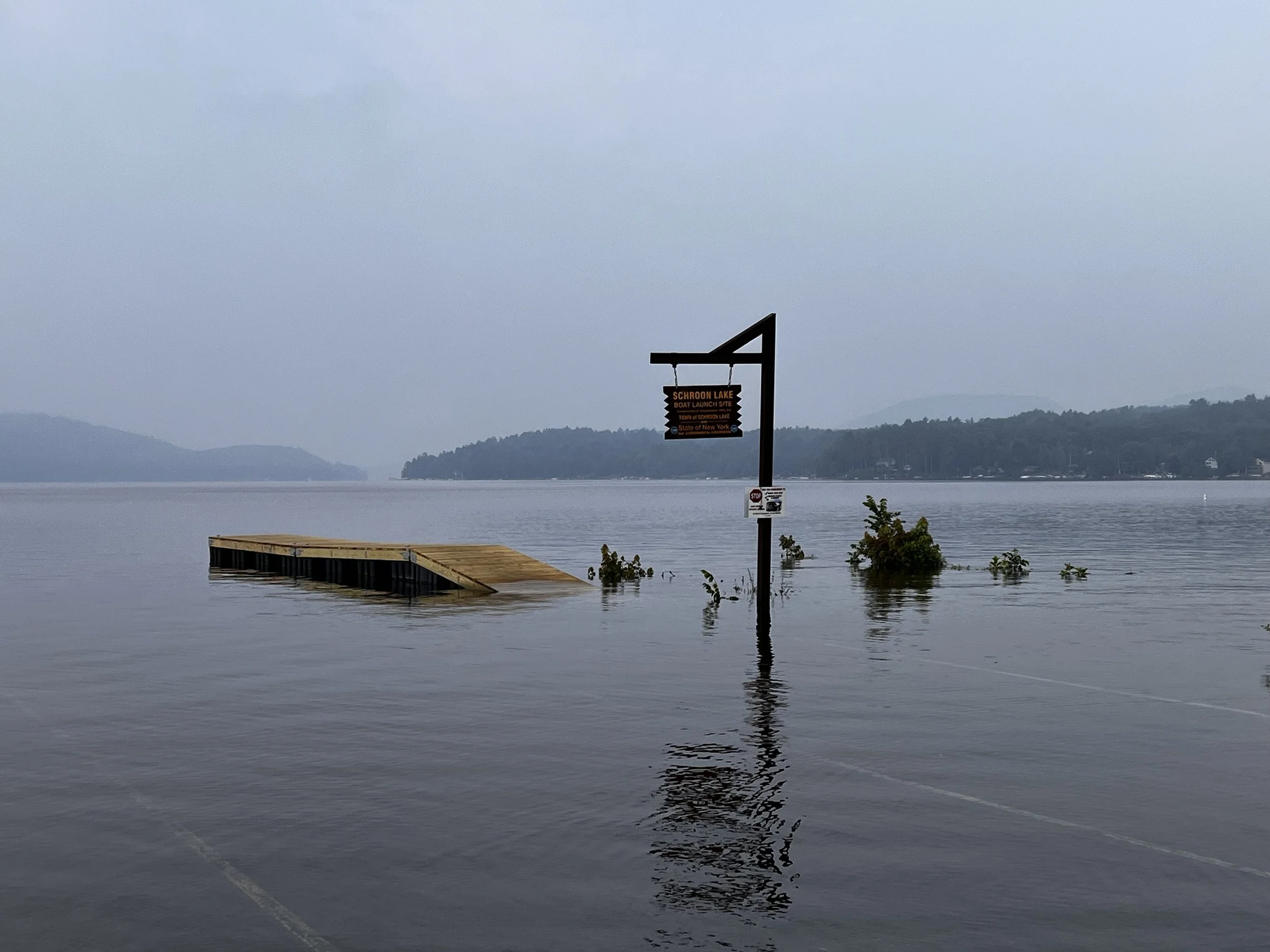
July 2023
By Neil Chippendale
Climate Change
In the North Country of New York State there is much evidence that our climate is changing. Temperatures are increasing, overall rainfall is increasing slightly, and there is a large increase in the frequency of violent storms that can dump 4-5 inches of rain in a short amount of time. All these present challenges to the Schroon River Watershed. Increasing temperatures can mean a decrease in snowpack and increasing rain events during the winter period. Schroon Lake has seen a number of high water events in the last decades (2011, 2019, 2023), where the river system fills up quickly but is slow to drain, causing property inundation and disruption of our tourist industry. The Schroon Lake Association, in partnership with the Schroon Lake Park District, and the East Shore Schroon Lake Association have launched an engineering study of the Schroon River, South of the Lake, to investigate methods to mitigate damage from high water by improving lake drainage.
Schroon Lake has been seeing an increase in sediment deposits in the lake. Coupled with recent low water conditions (2024, 2026) these sediment deposits force homeowners to extend their docks, or remove their boats before the end of the usual season. The increase in violent storms and large water events increases the velocity of the river, which allows it to scour out more sediment and carry it to the lake, where the current slows and the sediment drops out of solution. The Schroon Lake Association, working in partnership with the Essex County Soil and Water department, and the Ausable Fresh Water Center, is developing plans to study the river north of the lake to examine mitigation actions that could help spread the water to reduce velocity and result in less sediment carried to the lake.
Such efforts include establishing and maintaining riparian buffers along the river and tributaries by planting native plants and trees. Climate friendly infrastructure, such as improved culverts and bridges that reduce the risk of flooding and can connect wetlands that have been constricted by road and other developments. These changes will also improve the habitat for fish and other animals, by reconnecting habitat. When streams are in disequilibrium erosion and accumulation of sediment occur. Stable streams minimize flood damage, maintain water quality, and provide healthy habitat for fish, animals, and people. Restoring a healthy free flowing stream by maintaining stream channels, stream banks, access to the floodplain, and the near stream environment, is critical to the watershed health.
Throughout the Schroon River Watershed streams are routed through structures that are narrower than the width of the streams under normal flow, and may not be able to handle flows during flood conditions. High flows increase water velocity eroding the stream bed and stripping the banks of plants that stabilize them, adding more sediment to the system. Replacing undersized culverts, while not inexpensive, is the most cost-effective way of improving the stream system.
Culverts
In a recent New York State guidance for new or replacement culvert projects on critical roadways, applicants should use design documentation or verification to show that they considered the more stringent of the following flood-risk management guidelines when determining design-flow elevations for inland streams as part of a comprehensive risk-management approach:
• The vertical flood elevation and corresponding flows that result from increasing current, relevant peak flows, for example, 100 year flood levels, to account for projected peak flows for the full, expected service life of the infrastructure, and that allow the culvert to fully pass the design flood without increasing headwater, and that provide at least two feet of roadway freeboard above the projected 100 year flood. An additional foot of roadway freeboard should be considered for culverts on critical roadways. If design of a bridge or culvert to avoid an increase of existing floods.
• The vertical flood elevation and corresponding flows resulting from the 500 year annual chance flood. Applicants for projects involving new or replacement culverts on critical roadways, in areas subject to sea level rise, should demonstrate, through design documentation or verification, consideration of the following as part of a comprehensive risk management approach. Final design guideline elevations should incorporate the highest sea level rise projections feasible, considering practicality, costs, risk tolerance, funding eligibility, and environmental effects.
The Changing Climate is a threat to all ecosystems and communities on the planet. The North County will likely do well compared to other parts of the world, but still threats exist and should be considered. Natural stream restoration and climate friendly infrastructure reduce the risk of future flood events and storm damage. In the long term, natural streams and climate friendly infrastructure reduce the risk and require less maintenance over the life of the structures. If you own stream or lakeside property you can maintain the riparian buffer. Large trees serve as anchors for the stream bank. If you lack stream or lakeside cover you can plant native buffers along the waterways.